 Religious geometry in prehistory

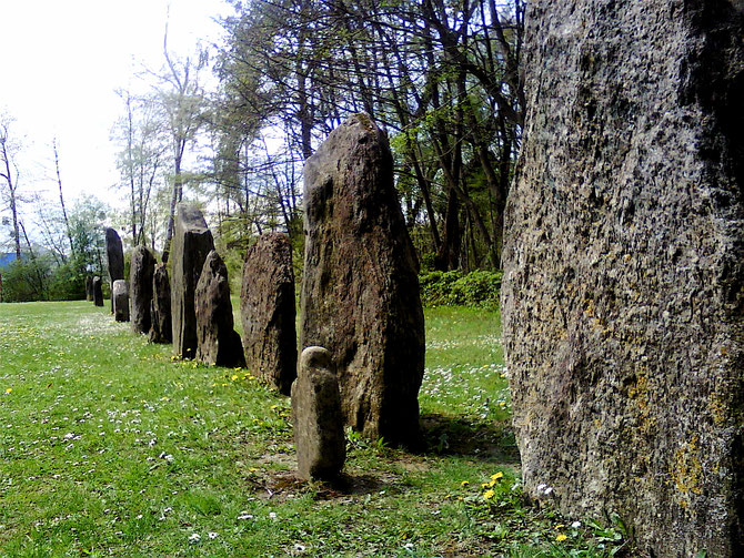
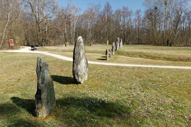
During about thirty years since the "reconstruction" (1986) of the megaliths on the site of 'Clendy' in Yverdon-les-Bains VD (Switzerland) the question of the signification of the two long
alignments ('North' and 'Central') has often been raised.
Especially Richard Walker ("Analyse der Megalithanlage Yverdon-les-Bains Clendy" 2014) und Ernst Born ("Die Megalithen von Yverdon-les-Bains" 2017) have explored possible astronomical
explications. This study, however, takes a terrestrial approach.
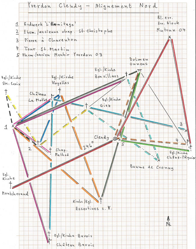
The central point for the determination of the orientation of these two alignments seems to be the intersection of the two axis (about 540.310/181.396), as was also proposed by R.Walker.
The North Alignment with its 246° azimuth seems pointed exactly to the church of Montcherand VD.
One should be reminded that the majority of ancient positions of churches and chapels seem to have superposed prehistoric 'cult places'.
The position of the church in Montcherand - this church is also well known for its medieval paintings - was apparently fairly important and occurs frequently in our research, e.g. in the study
"L'orientation de l'église de Chavornay VD". Without the trees which are
now to the west of 'Clendy' there would be direct sight contact between the Montcherand church and 'Clendy'.
'Clendy' is equidistant (12.33 km, always measured horizontally) from the church in Montcherand and from the large erratic stone to the south of the cemetery in Mutrux VD ("Mutrux 04",
546.165/192.325). The same distance a third time between this stone and the church of Chêne-Pâquier VD.
These large erratic stones were seemingly often "revered" in our regions, as our studies frequently suggest, probably also because of the unexplained rock quality. In this study we have the stone
"Mutrux 04", 'La Pierre des Buis'/La Sarraz VD, 'La Pierre de Charenton'/Rovray VD and the cup stone Abergement VD 01.
The straight line church Chêne-Pâquier - 'Clendy' passes via a former menhir 'Yverdon 03' (about 540.800/181.300) which is equidistant (7.70 km) from this church and from
the original position of the dolmen in Onnens VD (542.950/188.740) (which was detected only some years ago during the construction of a highway).
The straight line dolmen Onnens - church Chêne-Pâquier passes exactly via the impressive medieval tower 'St.Martin'/Molondin VD; 'Clendy' is now equidistant (7.76 km) from
this tower and from the dolmen in Onnens !
Such a "geometrical construction" is probably not fortuitous.
The straight line dolmen Onnens - former menhir Yverdon 02 leads to the church of Essertines-sur-Yverdon VD. The dolmen of Onnens is then equidistant (14.78 km) from this church
and from the earthwork (German: Erdwerk) <probably neolithic> 'L'Ermitage'/Baulmes VD (529.335/182.795).
The church in Essertines is then equidistant (12.53 km) from 'L'Ermitage' and from the church in Vugelles VD, and the straight line 'L'Ermitage' - church Vugelles goes
precisely over the ruins of the castle 'La Mothe'/Vugelles (built on a hill resembling a motte, therefore its name).
'L'Ermitage' is equidistant (5.01 km) from this castle and from the chapel in Mathod VD (533.370/179.750) which is the remainder of the former village church.
The straight line castle 'La Mothe' - chapel Mathod goes to the church in Bavois VD, and 'La Mothe' is equidistant (14.74 km) from this church and from the large erratic
stone 'Pierre à Charenton'/Rovray (547.920/182.230).
The church in Vugelles is also equidistant (6.07 km) from 'L'Ermitage' and from the former chapel 'St.Christophe'/Champvent VD (532.040/180.600).
For the Central Alignment its orientation (222°) seems to be directed towards the large erratic stone 'Pierre des Buis'/La Sarraz
(528.370/167.950), not visible from 'Clendy'. 'Pierre des Buis' is equidistant (17.84 km) from 'Clendy' and from the chapel in Ogens VD.
The distance between this chapel and 'Clendy' (9.02 km) is found several times and always interconnected ("multiple equidistance"): between the chapel in Ogens and the earthwork 'Poëpe'
(P.511)/Ependes VD, between 'Poëpe' and the large cup stone Abergement 01 (528.055/179.035), between 'Clendy' and the church in Concise VD, between the churches of Concise and Giez VD, and
between this church and the 'Manoir' in Valeyres-s.-Rances VD (a former convent 530.460/178.515) and a seventh time (!) - not indicated in the diagram since outside - between this 'Manoir' and a
likely 'cult place' P.1081/Ste.Croix VD.
The extension of the straight line cup stone Abergement 01 - earthwork 'Poëpe' goes exactly to the church in Ursins VD (built on a gallo-roman temple!), and this church is
equidistant (13.26 km) from Abergement 01 and from the church in Concise !
The impressive menhir in the vineyard of Bonvillars VD (541.326/187.576) is then equidistant (11.17 km) from the church in Ursins and from the earthwork 'Poëpe', but also from the earthwork 'La
Rape'/Démoret VD (547.510/178.220).
For lack of space in the diagram not indicated: the earthwork 'La Rape' is equidistant (6.63 km) from the church in Ursins and from a cross 'La Croix'/Cheyres FR (549.625/184.545).
These "terrestrial approaches" of the two alignments of megaliths in 'Clendy' could therefore be considered having given a satisfactory result, but an astronomical explanation at the same time is
also possible in theory.
However, these results do not support the suggestion that the North Alignment was constructed in the third millenary BC, in difference to the Central Alignment which is believed to be from the
fifth millenary BC, as was proposed by E.Burri-Wyser in "Chronique Archéologie Vaudoise 2015" (p.51).
Write a comment